From record heat to floods and drought – what’s in store if a ‘super’ El Niño hits this year
Climate scientists warn that the strongest El Niño on record could hit later this year, bringing with it more bouts of extreme weather.
Seasonal models are predicting an El Niño climate pattern that could be the strongest on record, bringing with it more bouts of extreme weather.
“I think we’re going to see weather events that we’ve never seen in modern history before,” WFLA-TV Chief Meteorologist and Climate Specialist Jeff Berardelli, in Tampa, Florida, warns.
An El Niño event is expected to develop from the middle of this year, impacting global temperature and rainfall patterns, according to the World Meteorological Organization. While the models indicate that this may be a strong event, the WMO cautioned that the models also have a harder time making accurate forecasts in the spring.
What is El Niño?
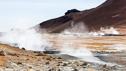
El Niño (Spanish for 'the boy') is a cyclical and natural warming of patches of the equatorial Pacific that then alters the world’s weather patterns. Its counterpart, La Niña, is marked by waters that are cooler than average.
Berardelli says that an El Niño event essentially redistributes heat on Earth. Currently, the subsurface heat in the Pacific is moving east across the ocean and ascending to the surface from the deep waters, the initial stages of El Niño.
RelatedThe WMO’s Global Seasonal Climate Update shows that sea-surface temperatures are rising rapidly. There is high confidence in the onset of El Niño, followed by further intensification in the months to follow, according to Wilfran Moufouma Okia, chief of climate prediction at WMO.
El Niño typically occurs every two to seven years and lasts around nine to 12 months, according to the WMO.
Why are scientists worried about this year's El Niño predictions?
It looks like the predictive models are onto something, says California Institute for Water Resources climate scientist Daniel Swain. That is because the volume and the intensity of the subsurface warm water anomalies — or pulses of unusually warm water that are a key part of El Niño physics— are about as large as we’ve seen in the historical record, he added.
The very strongest events are commonly referred to as “super El Ninos.” However, this term isn't used by the US National Oceanic and Atmospheric Administration (NOAA).
"One of the key building blocks to make it fully materialise is, in fact, occurring,” Swain said last week. “We still don’t know exactly what’s going to happen. It’s not guaranteed it’ll be a super El Niño. But the potential is there for something genuinely remarkable.”
RelatedIf the Pacific releases a lot of heat, it supercharges the climate system and wreaks havoc weather-wise, Berardelli explains. With more heat, there will be stronger heat waves, worsening drought in some areas, but also more moisture in the air that leads to more intense floods.
El Niño also subdues the hurricane season in the Atlantic because there is so much heat in the Pacific that outcompetes the Atlantic, Berardelli adds. Places like the Caribbean will be extra dry this summer and likely have fewer tropical systems, he warns.
What are the impacts of a super El Niño?
El Niño has global impacts. Across the United States, it looks like this summer will be hotter than normal, with significant heat waves. While the specifics are hard to pinpoint this far out, Berardelli is also expecting to see more frequent daily thunderstorms in the Southwest US.
Forest degradation, driven by wildfires, logging and drought, affects about 40 per cent of the Amazon. This could be exacerbated in 2026 with a strong El Niño.
The excess heat brought to the surface by El Niño, combined with the planet’s warming due to climate change, will lead to record-breaking global warmth, Swain says. He expects to see record global warm temperatures later this year, next year or both.
“All indicators are, at this point, that the next year is going to be a pretty wild year from a global climate perspective,” Swain adds.
Michael Mann, a University of Pennsylvania climate scientist, says that while El Niño boosts global temperatures a bit for a year or two, it’s basically a “zero-sum game.”
It typically oscillates back toward La Nina, which in turn lowers global temperatures for a year or two, he adds. The thing to worry about is the longer-term, steady warming trend that will continue as long as people continue to burn fossil fuels, Mann said last week.
Go to accessibility shortcuts Share CommentsRead more
Inside the race to tap into ‘superhot’ geothermal energy
Схожі новини
